About Us
The San Antonio Basin GSA (SABGSA) is a public agency formed by a joint powers authority between the San Antonio Basin Water District and the Los Alamos Community Services District. The agency was formed in June 2017 to sustainably manage groundwater in the San Antonio Creek Valley Groundwater Basin.
SABGSA Board Members
- Randy Sharer, 2026 Chair – Row Crops
- Patrice Mosby, 2026 Vice Chair – Vineyard
- Dan Chabot – Cattle
- Tom Durant – Permanent Crops
- Bart Haycraft – Vineyard
- Barbara Landon – LACSD Rep.
- Kenny Pata – Row Crops
- Chris Wrather – Transitional Land Use
Board Member Alternates
- Richard Kline – Cattle
- Jim Stollberg – Permanent Crops
- Brad Vidro – LACSD Rep.
- Open – Row Crops #1
- Open – Row Crops #2
- Open – Transitional Land Use
- Open – Vineyard #1
- Open – Vineyard #2
SABGSA Boundary
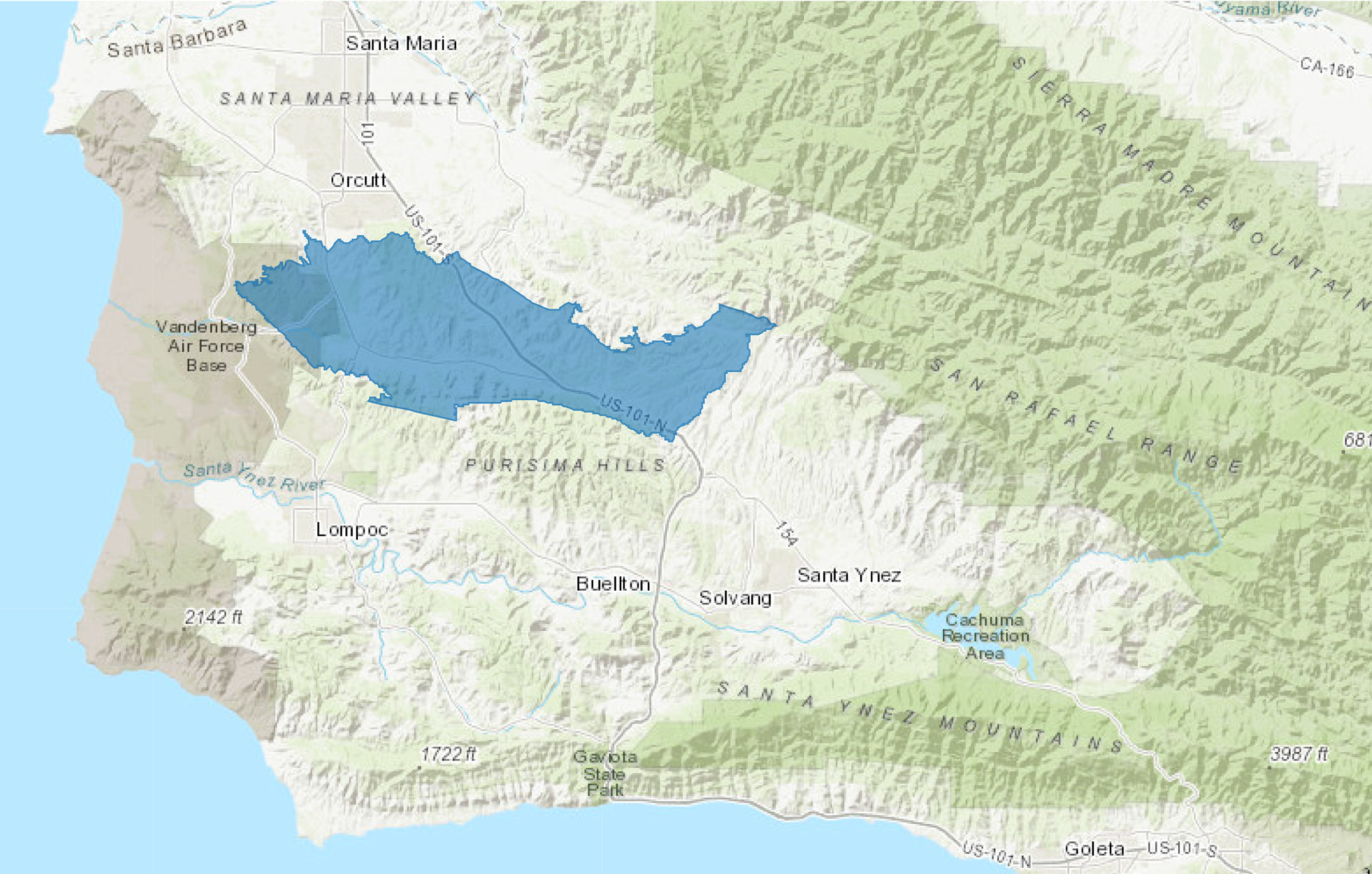
(click on the map for a larger view)
The Basin occupies approximately 123 square miles in western Santa Barbara County. It is bounded on the north by the Casmalia Hills and Solomon Hills, on the east by the San Rafael Mountains and a watershed divide separating the adjoining Santa Ynez River Valley groundwater basin, on the south by the Purisima Hills and Burton Mesa, and the west by the approximate western boundary of Barka Slough. The Basin has been designated by the California Department of Water Resources (DWR) as “medium-priority.”
Transparency
Transparency is a key element of public trust and confidence. We are committed to sharing information with the public about our operations and decision-making processes.